September 2017 Newsletter

We hope you and your family & friends were safe and dry during this devastating experience. Our neighborhoods were incredibly lucky and suffered minimal damage from Harvey. Once the rains let up, many of us took the opportunity to get out, walk the streets, chat with neighbors and even enjoy a meal at some of our local restaurants. It was great to see friendly faces and share experiences with neighbors and friends. It seems we all know someone who is in desperate need after the flooding and because of our good fortune, many of us had the time and means to help out. With so many ways to volunteer, we hope you have the opportunity to do your part for the communities who have suffered so much.

Pedestrians & School Traffic
HISD and most of the local schools will start back this coming Monday, September 11th. Please be on the lookout for added pedestrians heading to or returning home from school. Also, do your part to ensure safety and peace in our community by remaining patient with the increase in traffic that inevitably clogs our neighborhoods.

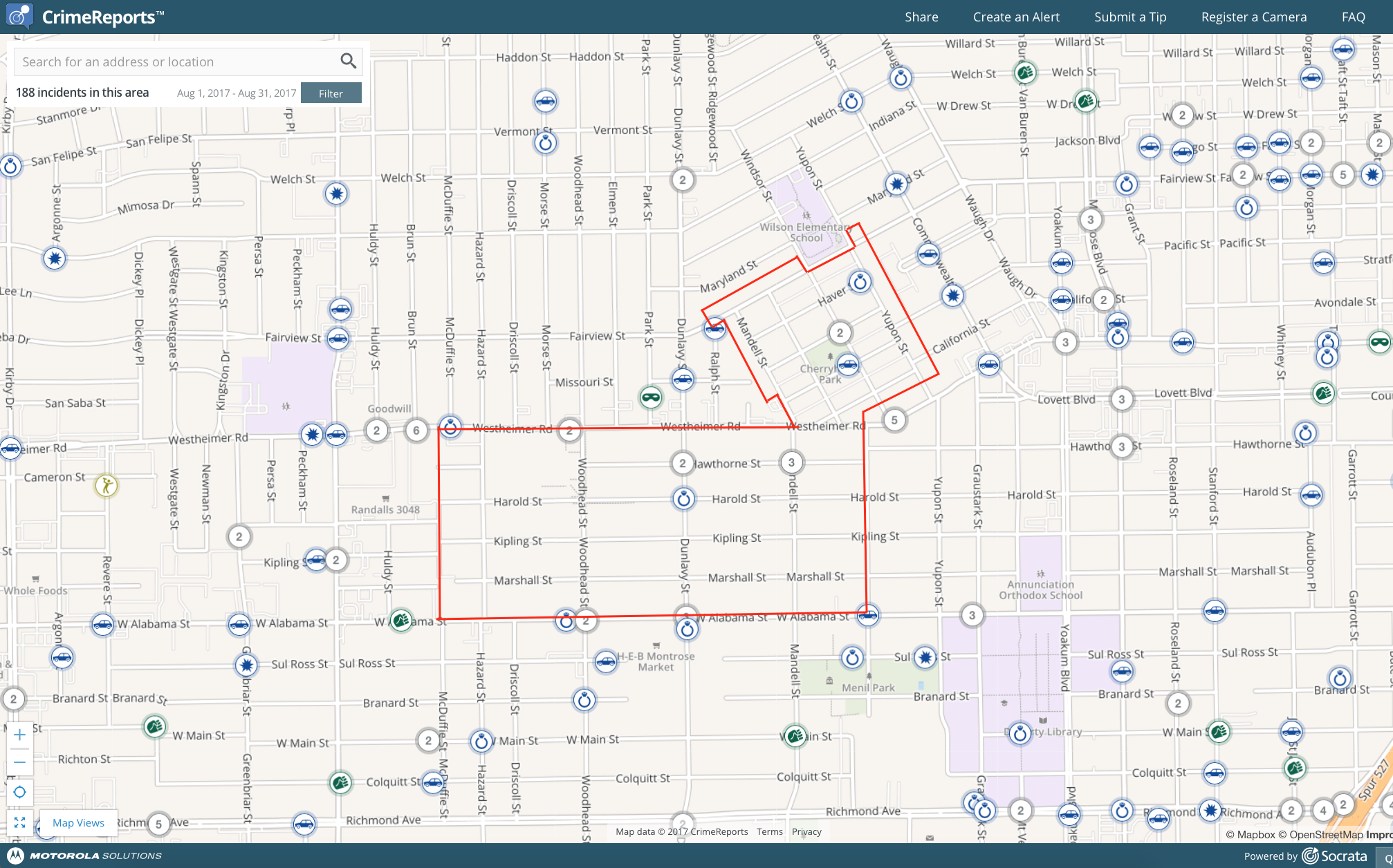
General Update: Reported crimes for August were low. Of the 10 reported, there were 6 thefts from vehicles, 3 thefts, and 1 breaking and entering.

Constable Activity Report – August:
Below is a run down of last month’s Activity Report from the Constable Patrol. Each time the deputy on patrol is called out or observes some activity of interest, he/she documents the call and the report is compiled at the end of the month. It’s a nice way to see what our deputies are up to!

Alarm Local – 6
Abandoned Vehicle – 1
Aggressive Animal – 0
Burglary/Habitation – 1
Burglary/Motor Vehicle – 0
Business Check – 3
Contract Check – 139
Criminal Mischief – 0
Discharge of Firearm – 0
Disturbance/ Loud Noise – 2
High Water Rescue – 2
Information Call – 2
Meet the Citizen – 68
Meet the Officer – 4
Neighborhood Check – 0
Park Check – 23
Property Found/Lost – 1
Solicitors – 3
Special Assign – 0
Suspicious Person – 12
Suspicious Vehicle – 4
Theft – 2
Traffic Hazard – 3
Traffic Stop – 25
Vacation Watch – 72
Welfare Check – 1

SaveSave

SaveSave

SaveSave

SaveSave

Safety Tip – Hurricane Preparedness

The Plans Before the Storm – from Harris County Constable Precinct 1

It’s here. Hurricane season has started, and it runs past September. The first tropical storm of the season, Arlene, has come and gone. The weather wizards predict a moderate-to-high storm count for 2017.

So it’s time again to prepare for your safety if and when a hurricane hits the Harris County area. Because a ho-hum attitude, a complacent approach, can be a danger by itself before heavy winds and rain arrive.

It’s the good fortune of Precinct 1 residents that clear instructions, advice and information are available from city government, county government and regional government. Please take time to click on those links and review the material.

For now, we address some of the most frequently raised concerns:

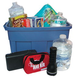
Supplies – Put together a kit now, before news media and government agencies report on a specific hurricane threat. Be ready for electricity outages by having on hand flashlights, batteries, cash (ATMs and banks don’t operate when there’s no juice!), battery operated radios, battery- or oil-operated lamps, non-perishable food, bottled water, etc.

Hurricane watch vs. hurricane warning – Don’t panic! When news media and the National Weather Service mention a hurricane watch, that means storm conditions – high winds, intense rain – are POSSIBLE here in the next 48 hours. A hurricane warning means those conditions are EXPECTEDwithin 36 hours. There’s an important difference, folks!

Either way, it’s time to protect windows and secure outdoor objects that can be lifted by ‘cane-force winds. As in trash cans, loose tree limbs, outdoor furniture. And be ready to deal with any special needs of children, the elderly and the infirm. Monitor level-headed news reports.

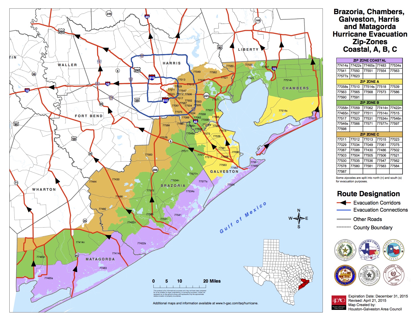
Evacuate vs. shelter in place – Precinct 1 is NOT in the “storm surge area,” which lies closer to the coast, if a hurricane makes a direct hit on Houston. This means we are not in the low-lying zones that would normally be told to evacuate to escape storm-driven waters from the Gulf of Mexico.

On the other hand, if cataclysmically powerful winds, of the type we haven’t seen here in modern times, are in the forecast, the advice to stay put could change. These conditions would arrive with a Category 4 or Category 5 hurricane, the most severe kinds. Again, calmly monitor government alerts.

The aftermath – When the storm has passed, look out for high water, downed trees and power lines. Prepare for several days without electricity unless you use a portable generator, which requires its own set of safety measures.

SaveSave

SaveSave